|

|
Rent
a GPS device:
(with
the option of uploaded tracks and waypoints) |
The
use of GPS (Global Positioning System) has become very popular
lately. We don’t intend to explain here how it works,
for that purpose, there are many sites in the Internet and
books about it. Our offer consists in renting a GPS device,
having in mind people who already know the basics about how
to work with it or have their own device, and to them we want
to give some advice to use in the field. |
| |
| When
is a GPS device useful? |
To
go on excursion with the support of a GPS equipment provides
great additional safety: Even if you don’t know the
area nor have prerecorded information, in case of getting
lost, with the help of the “Track Log”, you can
walk over your steps back to the starting point. If the equipment
has specific information --Tracks, Waypoints and/or Routes--
the possibilities multiply: You can let yourself be guided
by the device through a path, check every now and then if
you are on the right track or if you took the wrong turn on
the last bifurcation. The best advantage given by a GPS though,
is when there is no clear path because it is partially covered
by snow, it continues through rocks, or in case a sudden fog
wouldn’t allow you to recognize the exact point to reenter
the forest.
Besides
trekking and hiking excursions, there is another area where
it could be useful to rent a GPS: If you are the owner of
a property in the countryside, you can walk along the perimeter
to check the exact location of the field in satellite images
like Google Earth. The device can even calculate the area
within. |
| |
| Tracks,
Waypoints and Routes |
A
Track, or more precisely a Track
log, is the succession of geo referred points that
are automatically taken by the GPS device while we move. Each
point has the information about its exact location –the
coordinates and altitude- and time. With the distance and
time lapse between two points of the track, the equipment
can calculate the direction and speed. The track log is the
trail or print we left while we walk and is shown in the device’s
screen.
While the track log is the active recording during the walk,
we talk about a track when one is already saved and/or loaded
to a PC.
The
Track Back is a function of the GPS. It can
project the track log or any saved track and guide us through
the original path, to its end or to the beginning, depending
on what we want to do.
The Waypoint is different than a track point
since it is intentionally created by the user. Besides, the
information about the geographic location is identified by
a name –automatically created by the GPS or given by
the user- and it could be represented by a symbol of your
choice, like Campsite, Drinking Water, Danger, etc.
The waypoints are usually taken in significant places in the
field, like a junction, a river crossing, enter and exit of
a forest, fences and gates, houses, signs or marks, etc.
It is possible to navigate towards a waypoint (function GOTO),
but not to a certain track point.
A
Route is the sequence of waypoints in the
precise order you intend to use them. With the function “navigate”
activated, when you get closer to a waypoint the GPS automatically
indicates where the next is. Be aware that the GPS shows with
an arrow in a straight line towards the next waypoint, not
considering if there is an obstacle in the middle or if you
have to go around there. If the path between two neighboring
waypoints gets too far away from the straight line, you could
think that you are wrong. That is why it is better to create
additional control points, which is easy when you work the
track on the PC.
It is important to know that a route only exists along the
waypoints that create it, if you erase them from the equipment,
the route will disappear as well.
In
few words, we can say that a route consists of straight parts
between two waypoints. Even though the same happens with the
track and the track points, these are so close from one another
(according to the topography and speed of the person they
could be 5 to 20 meters apart) that projected in a map or
GPS screen, the track shows all the nooks of the trail. In
most of the GPS devices a route can take up to 125 waypoints,
meanwhile a recorded track can support up to 500 points, and
the track log up to 10.000. Generally it is not recommended
to load a track into the equipment as an active track log,
since this will take part of the memory and when full, it
won’t continue recording your trail or it will begin
rewriting on top of the first points of the track log. That
is the reason why the longer tracks we have are divided in
several parts up to 500 points each.
|
| |
| Precison: |
The
accuracy in the measuring depends directly on the number of
satellite that the equipment can find. According to our experience,
90% of the time the precison indicated is within 10 meters
radium. In an open field without forest and no mountains,
the measurements can be as exact as 5 meters. If you are at
the steep side of a mount, you loose the information of the
satellites that are “behind the mountain”. Also
inside a forest with tall trees the reception is poorer. If
two of these incidents sum up, it could be impossible to find
a signal to help you find your location.
It is important to know that to a GPS it is harder to find
a position inside a forest if the device was off at the moment
of entering it, rather than if the equipment was continuosly
on.
|
| |
| The
GPS device: |
We have equipments Garmin eTrex Euro for rent, which are simple,
but accurate and easy to work with. We give them with a quick
starting guide in English, German or Spanish, along with the
original manual in English (or if you prefer as a PDF document
in either Spanish or German).
The
prices for renting are (1 US$ aprox. 500 Ch$):
| 1
day (24 hours): |
Ch$
5.000 |
| 3
days: |
Ch$
10.000 |
| 7
days: |
Ch$
20.000 |
We
also ask for a deposit of Ch$ 75.000 or US$ 150 that we will
give you back when you return the equipment.
Batteries are not provided.
If
you want to know the Garmin eTrex, you can download the manuals
as a PDF.
| |
Guía
Rapida/Quick Start |
Manual |
| Español |
|
|
| English |
|
|
| Deutsch |
|
|
|
| |
| Geo
referred data: |
We
have geo referred data of all the excursions described in
“Hikes”. Each pack consists of one or several
tracks, the corresponding waypoints and the route. In that
way the user can choose how to navigate.
If
you want to rent one of our GPS devices, you can tell us which
data you need to load on it. For people with their own devices,
we can sell them just the data.
For more information please visit > 
NOTE:
For coordination purposes, the rental of the equipment
and the purchase of geo referred data should be requested
a couple of days in advance via e-mail.
|
| |
| Important: |
Handling
the rented GPS device, as well the geo referred data we provide,
is exclusive responsability of the user. We tried to create
it with the most possible accuracy, but we cannot exclude
that there may be errors and/or measuring imprecisons.
We refuse responsability if you get lost and/or suffer an
accident. A GPS device is a wonderful help for orientation
and navigation, but does not replace the necessary attention
and use of commun sense by the excursionist. |
| |
|

Tinquilco lake - Los Lagos Trail
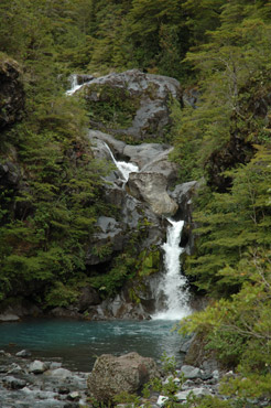
Pichi Turbio waterfall
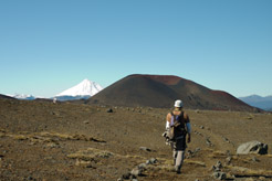
 Calabozo hills- Trail Los Cráteres
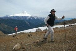
Climbing the Quetrupillán

Volcanoes Lanín and Quetrupillán from the Mirador
del Cañi

Huesquefilo Lagoon with the snow covered Sollipulli

Buried forest - Trail Nevados
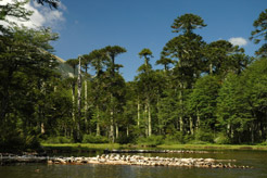
Huerquehue lagoon
Heading towards the Lanín in the trail Challupén -
Chinay
|