|

|
| "Los
Lagos" Trail – Huerquehue National Park |
|
Leider
hatten wir bisher noch nicht Gelegenheit, diese Seite ins
Deutsche zu übersetzen. Bei eventuellen Fragen können
Sie sich aber an uns wenden. |
| |
| It
is the most popular excursion in the Huerquehue National Park.
Its main attraction is the forests of ancient araucaria trees
that surround the lakes in the high zone. Seeing them is a magical
experience that makes some wonder about the small and ephemeral
the human being is in comparison to nature. In summer, the brave
ones can even swim in the cold waters. You can also see a variety
of birds, especially ducks, and with luck and patience you will
also be able to see the carpenter at work, with its impressive
red head. |
|
 |
| General
Information: |
| |
Distance
and duration:
There is the option to make the Small Circuit that visits
the lakes Chico, Verde and Toro, or the Big Circuit which
includes also the lagoons Los Patos and Huerquehue.
Small Circuit: From the CONAF control there are 12.9 kilometers
up and back, 4½ o 6 hours. Starting point at 780 meters,
maximum height 1.350 meters, total ascent 730 meters.
Big
Circuit: 16.2 km up and back, 5½ to 8 hours. Starting
point at 780 meters, maximum height 1.480 meters, total ascent
1080 meters.
If you drive until the beginning of the trail, you can take
3.6 kilometers and 40 to 50 minutes.
Physical
demand:
Small
Circuit: low to moderate, but you must not underestimate the
500 meters ascent to get to the first lake, but making the
necessary pauses it can be a familiar excursion.
Big Circuit: moderate.
Orientation:
Easy,
the trail is well marked with signs.
Best
time to do it:
December to May. From June to November, it is not possible
to make the Big Circuit that incudes the ponds Los Patos and
Huerquehue. Although the park remains usually open all year
round, after heavy snow fall, Conaf may restrict access and
allow only to walh up to Nido de Águila waterfall.
Equipment:
We
recommend trekking boots and hiking poles. There are some
muddy parts after rain and ice melting. In the dry season
it is enough with good sport shoes. Even though you could
drink water from the lakes, it is better to take along enough
water, since there are no rivers in the way uphill.
Entrance
fee:
Tickets must be bought before at www.pasesparques.cl and shown at the CONAF
ranger station. |
| |
 |
| How
to get there: |
From
Pucón, take the road to Caburgua until km 20. There
you have to turn right, there is a sign to Huerquehue National
Park, and you have to continue through a gravel road that
gets to the hamlet of Paillaco at km 27. From here the road
continues uphill to reach at km 32 the Tinquilco Lake and
at km 34 the entrance to the park where is the rangers’
control office and visitor’s center of CONAF.
The road continues in regular condition (not recommended for
low vehicles) for about two kilometers until the end of the
lake, where there is a parking lot that charges for the spot.
There is public transportation (Buses JAC) until CONAF. Along
the shores of the Tinquilco Lake there are several simple
campsites, a couple of bed & breakfast, and two nice hostels.
It is possible to get bread, eggs and some basic groceries,
but it is better to bring what you need from Pucón.
|
| |
 |
| Route
description: |
From
CONAF, only 300 meters ahead you have the option to take the
Trail Ñirrico. Meanwhile the gravel road climbs to
a certain height above the lake; the trail gets down and almost
touches its waters. During the walk you will find five signs
with information about the flora and fauna of the park. 800
meters ahead, the road and trail get together and cross several
private properties that are located at the end of the lake.
Then the road gets to a ford through the main water entrance
to the Lake Tinquilco, which is also the outlet of the small
lakes we are going to visit. If you are driving a car, it
is better to park here, since the road ends shortly afterwards.
A fallen trunk serves as a pedestrian’s bridge over
the river. To the left there is the nice Refugio Tinquilco
Lodge which offers bed& breakfast. Here starts the trail
marked “A los lagos” (To the lakes). The path
climbs an old timber trail along the mountain slopes through
a forest with giant coigües, mañíos and
a lot of quila (bamboo). 30 minutes after the ford and after
walking through a plateau, we cross a fence that indicates
that we are entering again the National Park. Then we cross
a small shelter from CONAF with potable water. Immediately
afterwards there is a marked detour to see the waterfall Nido
de Aguila (Eagle’s Nest).
Now starts the steepest part of the trail, going on zigzag
and gaining quickly height. Almost all of the part uphill
goes under the shadow of the forest; there are only two viewpoints
to the Lake Tinquilco with the Villarrica Volcano at the bottom.
There is another short detour to the waterfall Trufulco. After
climbing about 1 to 1½ hours in all, we will see the
first araucarias, and immediately we get to a small hill at
a height of 1.250 meters. Now the trail gets downhill to the
Lake Chico with its crystal clear waters and surrounded by
impressive 500 to 1.000 years-old araucarias. After continuing
along the lake, we get to a bifurcation: to the right there
is shortly ahead the Lake Toro, but we suggest taking the
trail to the left that, after a small climbing, will lead
you in less than 10 minutes to the Lake Verde. Near its outlet
there are good places for a picnic. There is a trail that
continues along the lake to the left with nice views that
ends at a shore point.
The main trail crosses the outlet of Lake Verde, continues
through the other shore and soon gets uphill again. After
5 minutes we get to a bifurcation: here the Circuits Big and
Small separate. |
The
trail to the right crosses a hill a will soon bring you
to Lake Toro. When it comes together with another trail,
you have to take again the one to the right to get in 15
minutes to the bifurcation at the end of Lake Chico and
get back through the same trail we came from.
|
To
take the Big Circuit, at the bifurcation after Lake Verde you
have to take the trail to the left. It continues uphill, but
not as steep as before. The forest is not so thick here, and
the lenga is the main tree you will see. This area is full with
wild flowers in the springtime, and in the fall the tree leaves
turn red. About 30 to 40 minutes after leaving Lake Verde you
will reach the small Laguna Los Patos. Near its outlet there
are a number of young araucaria trees, about a meter high. Now
you are over 1.450 meters.
From the Laguna Los Patos the trail turns to the southeast and
starts to go downhill towards the Lagoon Huerquehue that you
will reach in 20 minutes. Here there is marked detour to the
Hot Springs of Río Blanco which are about a 5-hour-walk
ahead. The trail to the right continues downhill and will bring
you in 15 to 20 minutes to the north shore of the Lake Toro.
Then it goes along its full length in a continuous up and down.
After 15 minutes it comes together with the trail of the Small
Circuit, which comes directly from Lake Verde. Shortly afterwards
there is marked detour “La Puntilla” which ends
in the shoreline in a big rock, a good place for a refreshing
dip in the waters. Few minutes later you will get to the end
of Lake Toro and then the bifurcation to Lake Chico closes the
circuit and you will have to take back the same trail you used
uphill. |
|
 |
| Logistische
Unterstützung: |
Guide:
Sie können für diese Wanderung einen Deutsch sprechenden
Führer für Ch$ 80.000 (US$ 100) anmieten.
Transport:
Wenn Sie ohne Farzeug unterwegs sind, können wir Ihnen
Transport zum Startpunkt vermitteln (bitte mindestens einen
Tag im voraus bestellen). Dies sind die möglichen Alternativen,
Preise pro Gruppe bis zu 4 Personen:
| Transport
zum Wanderbeginn: |
Ch$
40.000 |
| Hinbringen
und Abholen (am selben Tag): |
Ch$
70.000 |
| Transfers
und Wanderung mit Deutsch sprechendem Führer |
Ch$
120.000 |
|
Preise
für Gruppen über 4 Personen auf Anfrage.
Wichtig: Mögliche Eintrittsgebühren
sind nicht inbegriffen.
GPS Miete:
Wir können Ihnen einen GPS-Empfänger Garmin eTrex
mit den für diese Wanderung nötigen Tracks und Waypoints
vermieten.
Für nähere Informationen > 
|
|
|
|
Click
here
to see enlarged images
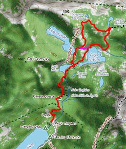
Area map

View of Tinquilco lake and Villarrica volcano
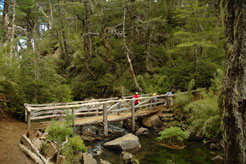
Bridge over the Lago Chico outlet
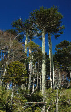
Araucaria trees near Lago Verde
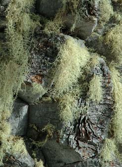
Araucaria bark
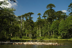
Laguna Huerquehue
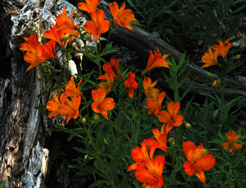
Flowers from the alstromerias family

Lago Toro
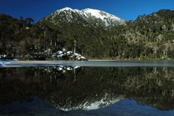
The Huerquehue National Park keeps its beauty also in winter
|


