|

|
| Hikes'
and treks' descriptions: |
In
this section we introduce different walking excursions within
the Pucón and Curarrehue regions. Some are easy to
make and even people with no experience can do them by themselves.
Others are more demanding and knowledge in orientation and
cartography are a must, otherwise you must take a guide to
come with you.
If
you contact us with time, in TravelAid we can contact an English
or German speaking guide that knows the place to drive along
with you, or just help you find transportation to the desired
area.
Besides, we have maps of the zone, GPS devices uploaded with
tracks and waypoints of the desired excursion, and -if carrying
your own GPS- we can sell you this information to load into
your device.
Most
of the hikes go along protected areas like national parks
or reservations. Sometimes the access is through private roads.
It is important to respect these private properties, close
carefully all gates that you must cross, and always ask for
permission to pass. If a gate is locked and there is no house
nearby to ask, you must leave your car in a place not blocking
the way. However -save by the times there are signs "Prohibida
la entrada" or "no Pasar" meaning "No
Trespassing"- the owners generally don't bother if you
follow the marked trail. You must try to make the less impact
possible avoiding littering, pull out plants, scratching trees
or making bonfires in places not allowed for it. |
| |
| "Mirador
Los Cráteres" Trail - Villarrica National Park |
It
is a little known hike, eventhough it is close to Pucón.
Its main attractions are the wonderfull views towards the
volcano and the lake, and a bizarre formation of small craters
inside a lava field.
For
detailled information>  |
| |
| "Pichillancahue"
Trail - Villarrica National Park |
Interesting hike to the most accessible glacier of the Villarrica
volcano. It doesn't match the typical image of a glacier,
since it is covered with volcanic ashes. The trail starts
in a beautiful araucaria forest and offers impressive views
to five volcanoes.
For
detailled information>  |
| |
| "Los
Nevados" Trail - Villarrica National Park |
Excursion that goes along the east side of the Villarrica
volcano through a high volcanic desert, that sometimes looks
like a moon landscape. You can see several ancient secondary
craters and there is a good view towards the Quetrupillán,
Lanín and Llaima, but you can seldom spot the top of
the Villarrica itself.
It is possible to combine this excursions with the trail “Challupén
– Chinay” and get almost all around the Villarrica
in three days, or –making the hike the other way round-
start here the traverse towards Laguna Los Patos and Puesco.
For
detailled information> 
|
| |
| Hike
to the Valleys Turbio and Correntoso - Villarrica National Park |
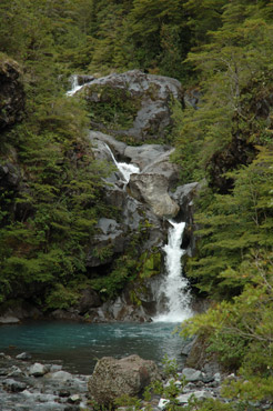
Interesting
excursion that shows you the areas that were affected by ancient
lahares (volcanic slides) and lava flows that created a number
of waterfalls. It offers spectacular views to the Villarrica
volcano and an impressive contrast between barren volcanic
dumps and areas of lush forests. Eventhough the area is very
close to Pucón, and some parts are inside the Villarrica
National Park, it is not a very visited place.
For
detailled information> 
|
| |
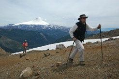
| Ascent
to the Quetrupillán Volcano - Villarrica National Park |
The
Quetrupillán, 2.382 meters high, is located just in
the middle of the well known volcanoes Villarrica and Lanín.
It is a good alternative for those who want to avoid the crowds
that daily climb the Villarrica. The view is equaly spectacular,
but it is not an active volcano. Many people consider its
ascent more attractive, since part of if goes through a lush
forest. Until the beginning of the summer (mid December) there
are still snow fields, but no glaciers to be aware of.
For
detailled information> 
|
| |
Villarrica-Traverse,
First Part:
Ski Center to Chinay
"Challupén
- Chinay" Trail - Villarrica National Park |
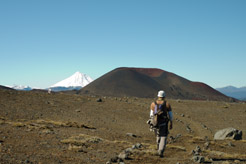
It
is the first part of the famous trekking known as the “Villarrica
Traverse”, which crosses through the namesake National
Park, from the Villarrica volcano until Puesco, almost at
the border with Argentina. This part gets around an active
volcano through its west and south sides, offering spectacular
views to its glaciers and lakes below. Most of the time the
hike goes over the limit of the forest, the trail crosses
areas of ancient lava flows, but also lush lenga and araucaria
forests.
For
detailled information> 
|
| |
Villarrica-Traverse,
Central Part: Chinay/Palguín Alto to Puesco
“Los Venados” and “Las Avutardas” Trails
– Villarrica National Park |
It
is the most popular excursion among the ones that last more
than one day. It offers a wide variety of landscapes, from
different kind of forests, highland pastures and marsh zones,
to extensive volcanic dump areas and highland deserts. It
also visits three lagoons that could not be more different
from each other.
This trail is part of the “Sendero de Chile”,
a project to connect the whole country through a pedestrian
trail from north to south, and that should be finished by
2010 to commemorate the bicentenary of the Chilean Independence.
For
detailled information> 
|
| |
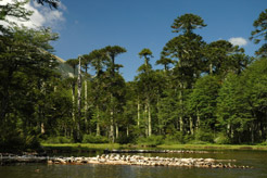
| "Los
Lagos" Trail - Huerquehue National Park |
It
is the most popular excursion inside the Huerquehue N.P. Its
main attraction are the ancient araucaria forests that surround
the lakes in the upper part. Watching them is an overwhelming
experiencie that makes us think about the smallnes of the
human being in comparisson to Nature. In summer, the brave
ones can even swim in the cold waters. You will also see a
variety of birds, specially ducks, and with luck and patience,
you will be able to see the woodpecker with its impressive
red head.
For
detailled information> 
|
| |
| "Quinchol"
and "San Sebastián" Trail - Huerquehue National
Park |
Inside
the Huerquehue National Park there are other less visited
trails than the one to the lakes. There is a trail that climbs
the Cerro Quinchol, which lays east of the Tinquilco lake.
From its summit there is a wonderful view to different volcanoes
and mountains.
From Cerro Quinchol there is also the possiblity to extend
the excursion through the trail San Sebastián until
reaching the summit of the namesake mountain, which with almost
2000 meters height is one of the highest in the park.
For
detailled information> 
|
| |
|
Laguna Huesquefilo - Villarrica National Reserve |
Short
hike towards a remote lagoon in the middle of the Andes, surrounded
by araucarias. It offers spectacular views towards the snow
covered summit of the Sollipulli. However, since it is at
a considerable distance from Pucón, it is better to
combine this circuit with other excursions, instead of making
it a day hike.
For
detailled information> 
|
| |
|
El Cañi Sanctuary |
El
Cañi is small private protected reservation area, on
the way to Huife. Its main attractions are the breath taking
araucarias, several small highland lagoons and the most impressive
view in 360° of the region.
For
detailled information> 
|
| |
|

Tinquilco lake - Los Lagos Trail
Pichi Turbio waterfall
 Calabozo hills- Trail Los Cráteres
Climbing the Quetrupillán

Volcanoes Lanín and Quetrupillán from the Mirador
del Cañi

Huesquefilo Lagoon with the snow covered Sollipulli

Buried forest - Trail Nevados
Huerquehue lagoon
Heading towards the Lanín in the trail Challupén -
Chinay
|


 Calabozo hills- Trail Los Cráteres


